Applies To: ■ PoliteMail Desktop ■ PoliteMail Online ■ PMUA □ PoliteMail M365
Version: ■ 4.9 ■ 5.0 ■ 5.1+
PoliteMail will convert recipient IP address information into geographic data, so you may view a map of your open and click interactions. This map view enables drill-down to a state-level view (city-level view in Version 4.9x).
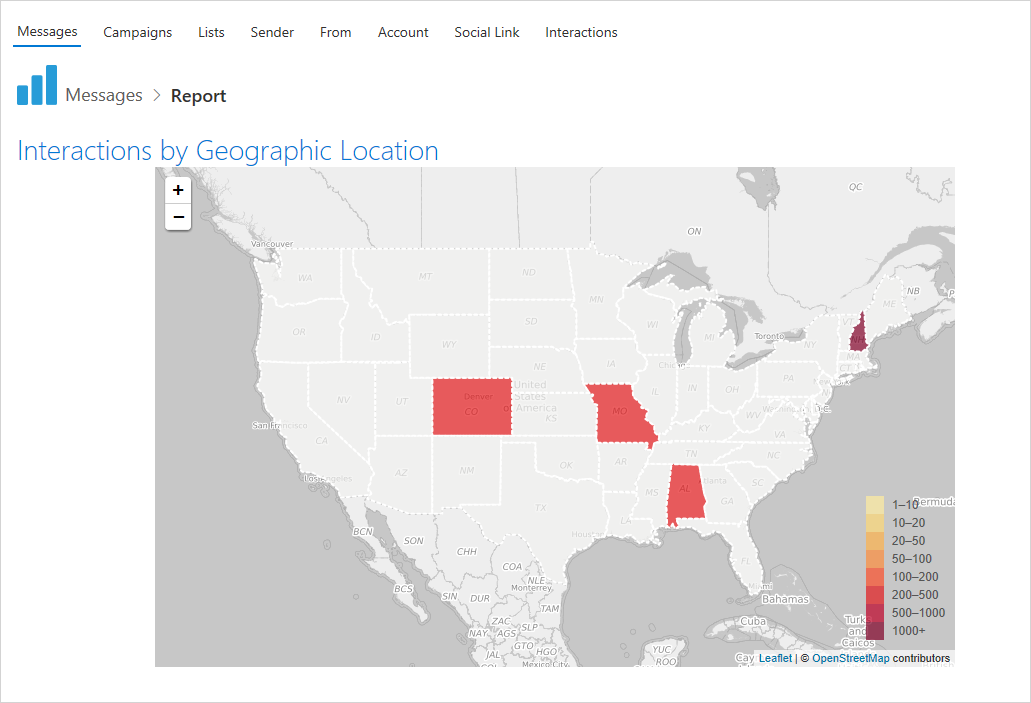
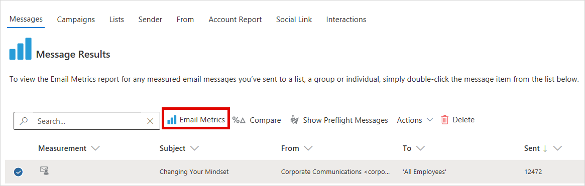
To see the maps, double-click the message or choose Email Metrics. Scroll down to reveal the map.
In anonymous and aggregate measurement modes, PoliteMail will store the longitude and latitude data from the IP conversion using the IP/Geographic database, but will not store the IP.
PoliteMail now includes GeoLite2 data created by MaxMind, available from http://www.maxmind.com.
The GeoLite2 databases are distributed under the Creative Commons Attribution-ShareAlike 3.0 Unported License.

